React component Maps API 2GIS
React component for 2gis-maps.
Installation
For installation use command npm install 2gis-maps-react 2gis-maps
Getting started
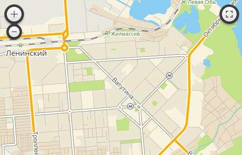
Creation of simple map. Api referense.
A map is a basic component.
For creating the map you need to specify center point, zoom level and size of dom element.
  <Map
      style={{width: "500px", height: "500px"}}
      center={[54.98, 82.89]}
      zoom={13}
  />
Creation of popup inside the map. Api referense.
A simple popup.
For setting of maxWidth, minWith and maxHeight use prop sprawling. Demo Source code
  <Map
      style={{width: "500px", height: "500px"}}
      center={[54.98, 82.89]}
      zoom={13}
  >
    <Popup
        pos={[54.98, 82.89]}
    >
       The content for popup
        <h3>Can be HTML</h3>
    </Popup>
  </Map>
Creation of Markers and Popups on Markers. Api referense.
Simple Marker
  <Map
      style={{width: "500px", height: "500px"}}
      center={[54.98, 82.89]}
      zoom={13}
  >
    <Marker
        pos={[54.98, 82.89]}
    />
  </Map>
Static and draggable markers.
Popups on Markers. Demo Source code
    <Map
        style={{width: "500px", height: "500px"}}
        center={[54.98, 82.89]}
        zoom={13}
    >
        <Marker
            pos={[54.98, 82.89]}
            staticLabel={'You can drag me.'}
            draggable={true}
        />
        <Marker
            pos={[54.98, 82.895]}
        >
            <Popup>
                The content for popup
                <h3>Can be HTML</h3>
            </Popup>
        </Marker>
    </Map>
Marker with icon and html icon. Demo Source code
    <Map
        style={{width: "500px", height: "500px"}}
        center={[54.98, 82.89]}
        zoom={13}
    >
        <Marker
            pos={[54.98, 82.89]}
        >
            <Icon
                iconUrl={'http://maps.api.2gis.ru/2.0/example_logo.png'}
                iconSize={[54.98, 82.89]}
            />
        </Marker>

        <Marker
            pos={[54.98, 82.895]}
        >
            <DivIcon
                iconSize={[54.98, 82.89]}
            >
                <h2>Can be HTML</h2>
            </DivIcon>
        </Marker>
    </Map>
Marker with label and static label. Demo Source code
    <Map
        style={{width: "500px", height: "500px"}}
        center={[54.98, 82.89]}
        zoom={13}
    >
        <Marker
            pos={[54.98, 82.89]}
            label={'I\'m label.'}
        />

        <Marker
            pos={[54.98, 82.895]}
            staticLabel={'I\'m static label.'}
        />
    </Map>
Creating of vector objects. Api referense.
Circle and Circle Marker. Demo Source code
    <Map
        style={{width: "500px", height: "500px"}}
        center={[54.98, 82.89]}
        zoom={13}
    >
        <CircleMarker
            pos={[54.98, 82.89]}
            label={'I\'m Circle Marker.<br/>My radius doesn't change when zooming.<br/>He in pixels.'}
            radius={50}
        />

        <Circle
            pos={[54.98, 82.895]}
            label={'I\'m Circle.<br/>My radius changes when zooming.<br/>He in meters'}
            radius={200}
        />
    </Map>
Polygon, Polyline and Rectangle. Demo Source code
    <Map
        style={{width: "500px", height: "500px"}}
        center={[54.98, 82.89]}
        zoom={13}
    >
        <Polyline points={[
                [54.9827,82.8958],
                [54.9837,82.8968],
                [54.9837,82.8938]
            ]}
        />

        <Polygon points={[
                [54.98214514427189, 82.89540767669679],
                [54.981683400666896, 82.89724230766298],
                [54.982754637698605, 82.89746761322023]
            ]}
                style={{
                    color: '#00FF00'
            }}
        />

        <Rectangle bounds={[
                        [54.9827238554242, 82.89354085922243],
                        [54.98205895253545, 82.89488196372986]
                    ]}
                        style={{
                            color: '#FF0000'
                    }}
                />
    </Map>
Events
For binding 2gis-mapsapi events use props similar to onEvent where Event is 2gis-mapsapi event with a capital first character.
Components
Map
Required props
| Prop name | Dynamic | Description | Data example |
|---|---|---|---|
| center | ✓ | Center position of map | [54.98, 82.89] |
| zoom | ✓ | Zoom level of map | 15 |
Optional props
| Prop name | Dynamic | Description | Data example | Default value |
|---|---|---|---|---|
| minZoom | ✘ | Minimal zoom level | 10 | null |
| maxZoom | ✘ | Maximal zoom level | 20 | null |
| maxBounds | ✘ | Bounds of map | [ [54.98, 82.89], [54.98, 82.89] ] | null |
| style | ✓ | CSS style of map container | {width: "500px", height: "500px"} | null |
| geoclicker | ✘ | Show popup on click about place on map | true | false |
| projectDetector | ✘ | Load current user project | true | false |
| zoomControl | ✘ | Show zoom control button | false | true |
| fullscreenControl | ✘ | Show fullscreen control button | false | true |
| preferCanvas | ✘ | Use canvas element for rendering geometry | false | true |
| touchZoom | ✘ | Zooming when touch (on mobile) | false | true |
| scrollWheelZoom | ✘ | Zooming when scrolling | false | true |
| doubleClickZoom | ✘ | Zooming when double click | false | true |
| dragging | ✘ | Dragging map | false | true |
Popup
Can be bound to Marker, Map, Polygon, Polyline, Rectangle.
Required props
| Prop name | Dynamic | Description | Data example |
|---|---|---|---|
| pos | ✓ | Position on map (not use if popup inside another element) | [54.98, 82.89] |
Optional props
| Prop name | Dynamic | Description | Data example | Default value |
|---|---|---|---|---|
| className | ✘ | Class name of popup dom element | example-string | - |
| maxWidth | ✘ | Max width of popup | 150 | 300 |
| minWidth | ✘ | Min width of popup | 150 | 50 |
| maxHeight | ✘ | Max height of popup | 150 | null |
| sprawling | ✘ | Popup width on map width | true | false |
Marker
Required props
| Prop name | Dynamic | Description | Data example |
|---|---|---|---|
| pos | ✓ | Position on map | [54.98, 82.89] |
Optional props
| Prop name | Dynamic | Description | Data example | Default value |
|---|---|---|---|---|
| label | ✓ | Text of marker label | [54.98, 82.89] | - |
| staticLabel | ✓ | Text of marker label. Label will be static. | [54.98, 82.89] | - |
| draggable | ✓ | Marker is draggable | true | false |
| clickable | ✓ | Marker is clickable | false | true |
Icon
Can be inside Marker.
Required props
| Prop name | Dynamic | Description | Data example |
|---|---|---|---|
| iconUrl | ✓ | Url of icon | http://maps.api.2gis.ru/2.0/example_logo.png |
| iconSize | ✓ | Size of icon | [48, 48] |
DivIcon
Can be inside Marker.
Required props
| Prop name | Dynamic | Description | Data example | Default value |
|---|---|---|---|---|
| iconSize | ✓ | Size of icon | [48, 48] | - |
| dangerouslySetInnerHTML | ✓ | Inner html | http://maps.api.2gis.ru/2.0/example_logo.png | - |
Ruler
Required props
| Prop name | Dynamic | Description | Data example |
|---|---|---|---|
| points | ✓ | Points of ruler | [ [54.9827,82.8958], [54.9837,82.8968], [54.9837,82.8938] ] |
Polyline
Required props
| Prop name | Dynamic | Description | Data example |
|---|---|---|---|
| points | ✓ | Points of line | [ [54.9827,82.8958], [54.9837,82.8968], [54.9837,82.8938] ] |
Optional props
| Prop name | Dynamic | Description | Data example | Default value |
|---|---|---|---|---|
| label | ✓ | Text of label | example-string | - |
| style | ✓ | Style of line | {color: '#FF0000'} | - |
Polygon
Required props
| Prop name | Dynamic | Description | Data example |
|---|---|---|---|
| points | ✓ | Points of polygon | [ [54.9827,82.8958], [54.9837,82.8968], [54.9837,82.8938] ] |
Optional props
| Prop name | Dynamic | Description | Data example | Default value |
|---|---|---|---|---|
| label | ✓ | Text of label | example-string | - |
| style | ✓ | Style of line | {color: '#FF0000'} | - |
Rectangle
Required props
| Prop name | Dynamic | Description | Data example |
|---|---|---|---|
| bounds | ✓ | Bounds of rectangle | [ [54.9827,82.8958], [54.9837,82.8968] ] |
Optional props
| Prop name | Dynamic | Description | Data example | Default value |
|---|---|---|---|---|
| label | ✓ | Text of label | example-string | - |
| style | ✓ | Style of line | {color: '#FF0000'} | - |
Circle
Required props
| Prop name | Dynamic | Description | Data example |
|---|---|---|---|
| pos | ✓ | Position on map | [54.9827,82.8958] |
| radius | ✓ | Circle radius in meters | 300 |
Optional props
| Prop name | Dynamic | Description | Data example | Default value |
|---|---|---|---|---|
| label | ✓ | Text of label | example-string | - |
| style | ✓ | Style of line | {color: '#FF0000'} | - |
CircleMarker
Required props
| Prop name | Dynamic | Description | Data example |
|---|---|---|---|
| pos | ✓ | Position on map | [54.9827,82.8958] |
Optional props
| Prop name | Dynamic | Description | Data example | Default value |
|---|---|---|---|---|
| radius | ✓ | Circle radius in pixels | 300 | 10 |
| label | ✓ | Text of label | example-string | - |
| style | ✓ | Style of line | {color: '#FF0000'} | - |
Wkt
Required props
| Prop name | Dynamic | Description | Data example |
|---|---|---|---|
| data | ✓ | Wkt data string | POLYGON((82.9155.04, 82.91 55.04, 82.91 55.04, 82.9155.04)) |
Optional props
| Prop name | Dynamic | Description | Data example | Default value |
|---|---|---|---|---|
| style | ✓ | Style of objeck | {color: '#FF0000'} | - |
GeoJSON
Required props
| Prop name | Dynamic | Description | Data example |
|---|---|---|---|
| data | ✓ | GeoJSON data object | { "type": "Feature", "properties": { "address": "г. Новосибирск, пл. Карла Маркса, 7" }, "geometry": { "type": "Point", "coordinates": [82.8974, 54.9801] } }; |
Optional props
| Prop name | Dynamic | Description | Data example | Default value |
|---|---|---|---|---|
| pointToLayer | ✓ | Function for render point | function() {} | Will be render simple Marker |
| onEachFeature | ✓ | Function running on every element | function() {} | - |
| filter | ✓ | Function for filter objects | function() {} | - |
| style | ✓ | Style of object | {color: '#FF0000'} | - |
Demo Development Server
npm startwill run a development server with the component's demo app at http://localhost:3000 with hot module reloading.
Building
-
npm run buildwill build the component for publishing to npm and also bundle the demo app. -
npm run cleanwill delete built resources.
