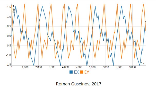
React Signals Plot
This is React Signals Plot component for geophysical data visualization.
The component supports 'on the fly' data compression. That's why you can use it for drawing line charts which contain millions of points. ReactSignalsPlot is an interactive component. You can use a mouse or touch to move and zoom.
Install
npm i --save react-signals-plot
Example
import React from 'react';
import ReactSignalsPlot from 'react-signals-plot';

const series = {
  data: [
    {
      id: 'EX',
      values: [
        { x: 1, y: 5 },
        { x: 2, y: 10 },
        { x: 3, y: 1 },
        { x: 4, y: 3 },
        { x: 5, y: 7 }
      ]
    },
    {
      id: 'EY',
      values: [
        { x: 1, y: 2 },
        { x: 2, y: 0 },
        { x: 3, y: 5 },
        { x: 4, y: 7 },
        { x: 5, y: 7 }
      ]
    }
  ],
  labels: {
    x: 'X, seconds',
    y: 'Y, volts'
  }
};

class PlotExample extends React.Component {
  render() {
    return (
      <ReactSignalsPlot
        style={ { width: '100%', height: 400 } }
        data={ series.data }
        samplesLimit={ 300 }
        labels={ series.labels }
        interactive={ true }
      />
    );
  }
}
Scripts
npm run build- build componentnpm run dev- start webpack-dev-servernpm run test- run unit tests