WORLD MAPS & FIGURES (WMF)
Caution: This project is a self-training project. As a matter of fact, I do not provide any guarantee in terms of provided data, nor any kind of results you as a user could expect from it.
I made this little project to discover advanced REACT features and D3.js.
This is how the “World Maps & Figures” (WMF) application took shape in July, 2022, somewhere on our wonderful planet…

THE WMF PROJECT
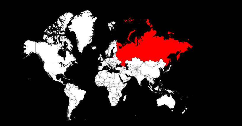
The project consists in building an interactive interface to browse World and Countries maps..
You will be able to play with more than a hundred of different map projections, some of them are very rare to observe…
The purpose of this application is not to provide absolutely perfect data about Countries, but to be a showcase of what I’m able to deliver as a developer.
This includes :
– quality, performance, efficiency, usability, robustness of concepts and codes…
– nice UI (User Interface) to make an app easy to learn and master…
I hope you will have a pleasant experience as trying my WMF application!
Please, don’t hesitate to send me any feedback about it: feedback is fuel of improvement!…
DEMO
GITHUB REPOSITORY
https://github.com/EmmanuelFRANCOIS/WORLD-MAPS-FIGURES
DATA SOURCES
MAIN TECHNOLOGIES IMPLEMENTED
|
ReactJS18.2
|
React-Bootstrap2.4
|
React-Query3.39
|
React-Table8.2
|
React-i18next11.1
|
|
|
Axios0.27
|
i18next21.8
|
D3.js7.6
|
|||
|
Bootstrap5.2
|
FontAwesome6.1
|
Sass1.53
|
HTML5
|
CSS3
|
JavascriptES6
|